

New York/Washington: The office of the US Trade Representative has removed a social media post that featured a map of India showing the entire region of Jammu and Kashmir, including Pakistan-occupied Kashmir, as well as the Aksai Chin region as part of the Indian territory.
Last week, as the US and India announced details of a bilateral interim agreement framework on trade, the US Trade Representative’s office posted information about the trade deal on the social media website X, along with a map of India.
The map had shown the entire region of Jammu and Kashmir, including Pakistan-occupied Kashmir (PoK), as territory of India. Similarly, the Aksai Chin region, claimed by China, was also shown as part of the Indian territory.
However, the specific post showing the map of India has now been deleted from the USTR’s X handle.Â
On previous occasions, maps of India had been shown with a demarcated line to portray the PoK and Aksai Chin region. But the map of India issued by the USTR had shown the entire region of Jammu and Kashmir, including these two areas, as an integral part of India.
New Delhi has consistently underscored that the entire Union Territory of Jammu and Kashmir has been, is and will always be an integral and inalienable part of India. India also asserts that Aksai Chin is an integral part of its territory based on historical claims and past treaties.
Previously, in the “standard map” released by China, the country has staked claim over Arunachal Pradesh, Aksai Chin region, Taiwan and the disputed South China Sea.
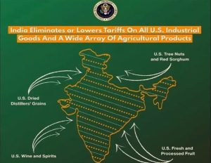
India and the US announced on Friday night that they have reached a framework for the first phase of the bilateral trade agreement under which both sides will reduce import duties on a number of goods to boost two-way trade.
PTI


